The Fire Island Inlet to Montauk Point study area generally extends from Fire Island Inlet easterly to Montauk Point along the Atlantic Coast of Suffolk County, spanning a distance of approximately 83 miles, comprising about 70 percent of the total ocean frontage of Long Island. Fire Island Inlet is located about 50 miles by water east of the Battery, New York City.
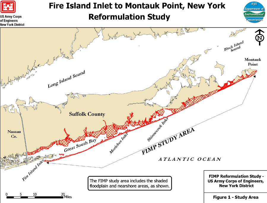 The study area considers reduction of storm damages to existing development along the shorelines of Great South Bay, Moriches Bay, and Shinnecock Bay, as well as existing development along the ocean coastline. As such, the study area encompasses the shorefront area, barrier islands, inlets, bay areas, mainland areas and suitable borrow areas, which could provide material for any beach restoration, along the south shore of Long Island from Fire Island Inlet to Montauk Point.
In order to ensure that the study area thoroughly investigates the potential positive and negative impacts associated with project alternatives the study area includes existing development on the mainland up to Sunrise Highway and Montauk Highway and also considers the shorefront area, extending westward of Fire Island Inlet a distance of approximately 2 miles.
For more information please read the Fire Island Inlet to Montauk Point Project Fact Sheet or email the Project Manager.